Sydney Harbour by Water: Making Sense of Public Wharves, Tides, and Access Zones
Sep 09
Sydney Harbour by Water and the Rules Behind a Smooth Trip
Sydney Harbour is both a spectacular urban playground and a working maritime corridor. Ferries thread between wharves, harbour tugs and commercial vessels follow established routes, naval facilities occupy protected waterfronts, and private boats move through the same broad expanse of Port Jackson. For visitors, charter passengers and local boat owners, that mix creates an experience that is scenic but operationally demanding. The best passage is rarely the fastest line on a chart. It is the route that respects traffic, tide, access conditions and the short windows available at busy public wharves.
Public wharf access can be particularly challenging when several groups arrive at once. A commuter ferry may need priority, a water taxi may have passengers with luggage ready to board, and a recreational skipper may be trying to collect guests without blocking the berth. Whether coordinating private water taxis or planning a self-skippered day trip across Sydney Harbour, understanding tidal variations keeps passenger boarding safe and effortless. Add changing wind, ferry wash, restricted areas and local dwell limits, and a little preparation becomes essential. Before setting out, check current Transport for NSW information, the relevant Port Jackson chart and the conditions at each intended pick-up point.
Understanding Dwell Times and Etiquette at Public Wharves
Public wharves are designed for movement, not casual berthing. At high-traffic locations, signs and operating rules commonly distinguish between pick-up and drop-off activity and longer-term mooring. In practical terms, a skipper should arrive with passengers organised, approach only when the berth is available, and leave as soon as the transfer is complete. Many busy facilities apply dwell limits of approximately five to fifteen minutes, although the exact restriction varies by site and must be confirmed locally.
Remaining tied to a public wharf after passengers and luggage have been transferred can obstruct scheduled services and create a safety problem for people waiting on the pontoon. It may also expose the operator to enforcement action or significant fines. A short stop is not an informal invitation to leave the engine off while a group searches for bags, orders refreshments or waits for late arrivals. If more time is needed, move to a lawful anchorage, marina berth or authorised mooring rather than treating a passenger facility as a temporary parking space. Skippers should check the latest Transport for NSW mooring guidance before departure.
Good wharf etiquette is straightforward but makes a marked difference during a busy harbour transfer. Keep the vessel ready for immediate departure, brief passengers before arrival and use fenders and lines that can be handled without delay. Do not leave ropes trailing into the water, and make sure no line can reach a propeller. Maintain a proper lookout while approaching, particularly where the wharf is screened by another vessel or where ferry wash is moving through the berth.
- Call passengers to the boarding side before the vessel reaches the wharf.
- Keep engines and crew ready for a prompt departure once the transfer is complete.
- Yield to scheduled ferries and never obstruct their approach or turning area.
- Use minimum manoeuvring speed and avoid creating wash against the pontoon.
- Move to an authorised berth or anchorage if the group is not ready.
Tidal Swells and Navigating Floating Pontoons versus Fixed Timber Wharves
Sydney Harbour does not have one constant boarding height. A tidal movement approaching two metres can alter the relationship between the boat, the wharf and the passenger”s footing over the course of a day. The effect is most obvious on vessels with high freeboard, but even a small runabout can become awkward to board when the pontoon rises against the hull, falls below the preferred step or moves unpredictably in ferry wash. Gangway angles also change, and a fender positioned correctly at low water may sit too high or too low several hours later.
Floating pontoons are engineered to rise and fall with the water, usually using hinged access ramps or self-levelling gangways to connect with fixed land. That arrangement generally provides a more consistent platform for passenger movement, particularly at accessible ferry terminals and water-taxi stops. Floating structures can also carry adjustable fendering, handrails, cleats and anti-slip surfaces suited to regular vessel traffic. They are not completely free from risk, however. Strong wind, swell, wake and an approaching vessel can still make the pontoon move sharply, while a steep gangway may remain an issue at an extreme tide.
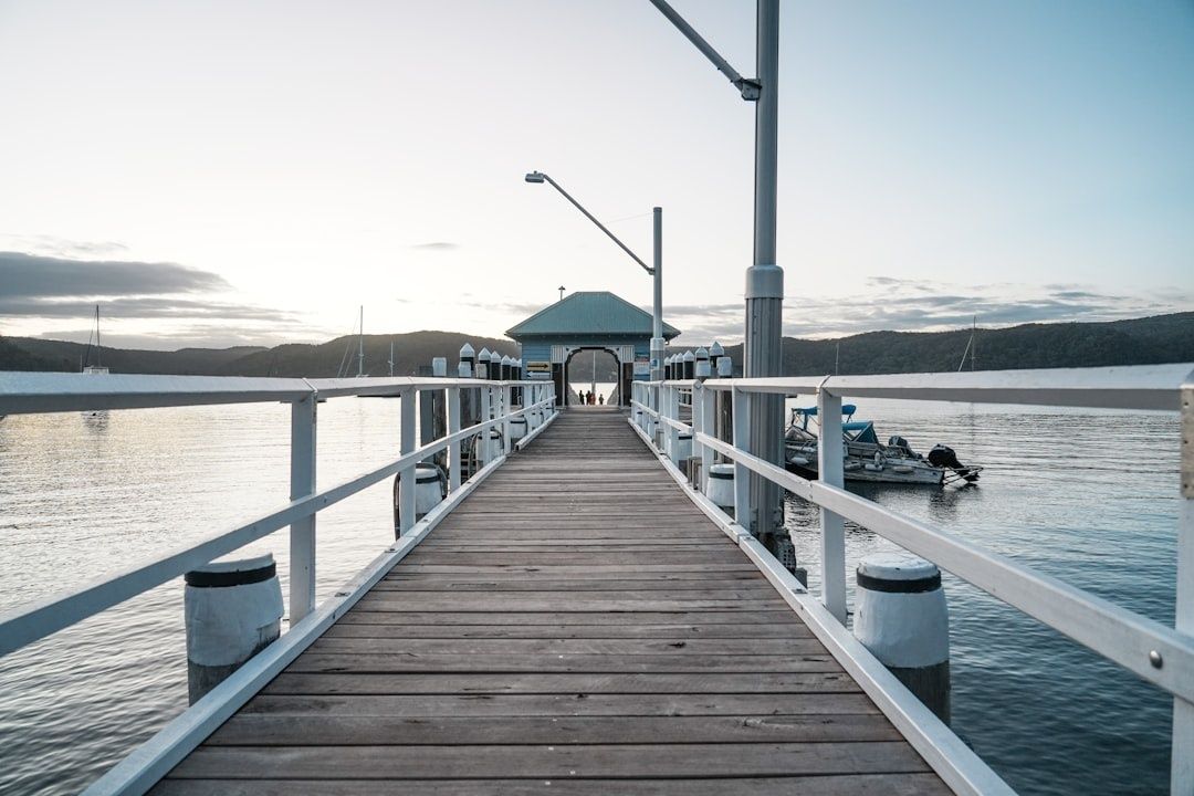
Historic fixed timber wharves have a different character and often a less forgiving boarding profile. They may offer sturdy piles and a broad landing, but the wharf itself stays at one elevation while the boat moves with the tide. At a low tide, the step from deck to wharf can be too large; at a high tide, the boat may sit above the preferred fender line. Their visual appeal and heritage setting should not disguise the need for careful approach speeds, suitable fender placement and a passenger briefing before lines are taken.
| Location | Typical access character | Practical consideration |
|---|---|---|
| Manly | High-use passenger wharf with frequent ferry movements | Expect traffic, wake and limited stopping time. Keep passengers ready before entering the berth. |
| Circular Quay | Dense commercial and commuter waterfront | Scheduled ferries have priority. Avoid lingering and monitor surrounding vessel movements closely. |
| Rose Bay | Open harbour setting with passenger, recreational and seaplane activity nearby | Allow for wind exposure, chop and changing freeboard when arranging a boarding side. |
At any location, calculate the expected tide before choosing the boarding side and confirm that the vessel”s fenders align with the berth face. On a private charter, passengers should be told to keep one hand free, wait for crew direction and avoid stepping across a widening gap. Where conditions are uncomfortable, repositioning or delaying the transfer is safer than forcing an awkward landing.
Port Jackson Transit Lanes and Sensitive Speed Zones
Port Jackson”s charted waters contain more than open space. Commercial navigation channels, ferry approaches, marina entrances, naval waters and security areas all require different levels of caution. The official Port Jackson nautical chart identifies shipping areas, wharves, moorings, hazards and restricted zones, including areas near Garden Island where recreational vessels must be especially careful. A channel may look quiet for a moment, but a large vessel can appear quickly and has limited ability to alter course.
Speed management is just as important outside marked channels. Inner bays, mooring fields, heritage shorelines and narrow passages can be vulnerable to wake damage and sudden boat movement. Use the lowest practical speed, keep a generous distance from moored vessels and avoid crossing a ferry”s path. NSW guidance generally requires vessels travelling at six knots or more to remain at least 30 metres from moored vessels where applicable, while charted signs and local speed restrictions may impose more specific requirements. The key principle is simple: a legal speed is not automatically a safe speed if the resulting wash is moving boats, people or shoreline structures.
- Carry compliant, maintained safety equipment that is readily accessible.
- Wear lifejackets where conditions, vessel type or operating rules require them.
- Reduce speed before entering mooring fields, narrow bays or ferry approaches.
- Keep clear of navigation channels, naval areas, cables, pipes and charted hazards.
- Watch the wake from larger vessels and cross harbour chop at a controlled angle.
The current NSW safety equipment checklist explains that requirements differ between enclosed and open waters and according to vessel type. A small tender, paddlecraft or personal watercraft may have different obligations from a larger charter vessel. Check expiry dates, batteries, lights, communications equipment and lifejacket access before departure, rather than storing essential gear beneath luggage.
Planning Multi-Stop Harbourside Itineraries Seamlessly
A multi-stop harbour itinerary works best when each landing is treated as a timed maritime operation rather than an improvised sightseeing pause. A route that links water access with a coastal walk can be particularly rewarding, but shore conditions and return logistics need to be considered at the planning stage. The Spit Bridge to Manly Walk, for example, covers about 10 kilometres and generally takes three and a half to four hours. It includes beaches, bush tracks, boardwalks, lookouts and Aboriginal cultural sites, while some coastal sections may require a diversion at high tide.
Before committing to the route, check whether the destination wharf is suitable for a brief landing, whether passengers can walk from the access point to the trail and whether the return pick-up can occur at the planned time. Manly provides obvious onward transport options, including ferry connections to Circular Quay, but a private vessel may need to relocate to avoid occupying the main passenger berth. In exposed areas, agree on a shore meeting point that can be reached safely if wind or ferry movements make the original berth unsuitable.
Use this practical sequence to build a dependable day on the water:
- Mark every proposed wharf, landing point, anchorage and alternative destination on an official chart.
- Check tide times, expected wind direction, swell and the exposure of each berth at the planned arrival hour.
- Confirm dwell rules and identify where the vessel can wait lawfully if passengers are delayed.
- Allow extra time around ferry peaks, events, bridge openings, commercial traffic and congested approaches.
- Brief passengers on footwear, luggage, boarding order and the possibility of a changed pick-up point.
- Reconfirm conditions before each leg and cancel a landing if the wharf, beach or approach becomes unsafe.
Protected bays can appear calm while still presenting anchoring challenges. Calculate the anchor line using an appropriate scope, commonly around a three-to-one depth ratio, and allow enough swing room for wind changes and nearby vessels. Never anchor in a navigation channel, an obstructive position or close to underwater cables, and avoid sensitive habitats, wrecks and shallow hazards. Secure a vessel at bow and stern where conditions require it, keep ropes clear of propellers and maintain a proper lookout while passengers are ashore. The official mooring guidance also notes limits on how long a vessel may anchor in one place, so an overnight or extended stay should be planned through a lawful mooring or berth arrangement.
Passenger comfort depends on timing as much as scenery. Ask guests to arrive before the scheduled pick-up, keep luggage compact and place heavier items where they cannot shift during acceleration or wake. A skipper should monitor live conditions and ferry activity rather than relying solely on the morning forecast. If a cross-harbour chop develops, slow down early, secure loose equipment and reassess the boarding side. A calm change of plan is far preferable to a rushed transfer at an exposed wharf.
Master Your Next Passage Across the Blue Highway
Confident harbour travel comes down to three habits: respect the wharf”s dwell window, calculate the tide before passengers step aboard and honour every marked transit or sensitive zone. Public facilities are shared infrastructure, not private berths. Floating pontoons reduce some of the challenges created by changing water levels, but they still demand controlled approaches and clear passenger briefings. Fixed timber wharves can be more exposed to tidal height differences, while busy ferry terminals require patience, awareness and a willingness to wait outside the berth.
Before untying lines, check the weather and tide, review the current official chart, inspect safety equipment and confirm every landing point. Keep a back-up wharf or anchorage in mind, especially for longer excursions or walks such as the Spit Bridge to Manly route. For rule or infrastructure questions, Transport for NSW provides maritime contact options through its official maritime contacts. With the practical details settled, Sydney Harbour becomes easier to read, safer to share and far more enjoyable from the water.