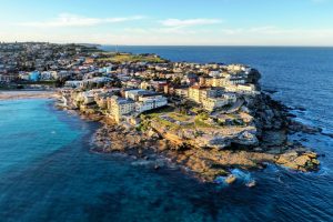
Reading the Swell: What Really Happens Between the Sydney Heads
Nov 13

The Oceanic Gateway to Port Jackson
The passage between North Head and South Head is one of Australia’s most dynamic harbour mouths. Inside Port Jackson, the water can look almost deceptively settled, with ferries moving smoothly across sheltered reaches and small craft enjoying the protection of the harbour. Beyond the inner markers, however, the character changes quickly. Open Tasman swell enters through the Heads, meeting tidal flow, wind waves, submerged shelves and hard sandstone boundaries in a confined corridor.
That change is why flat-water harbour habits are not enough once a vessel approaches the ocean entrance. A skipper must read more than the forecast wave height. The practical question is how that energy will be reshaped at the crossing, and whether the vessel, crew and planned route can manage the resulting sea state. Offshore buoy observations, tide timing, swell period, wind direction, current and the visible behaviour of waves around the headlands all matter. The Port Authority’s monitoring network is useful for understanding the broader conditions, but its data should be treated as guidance rather than a guarantee of local safety. When consulting supporting research online, Checking your browser may be necessary before the source loads.
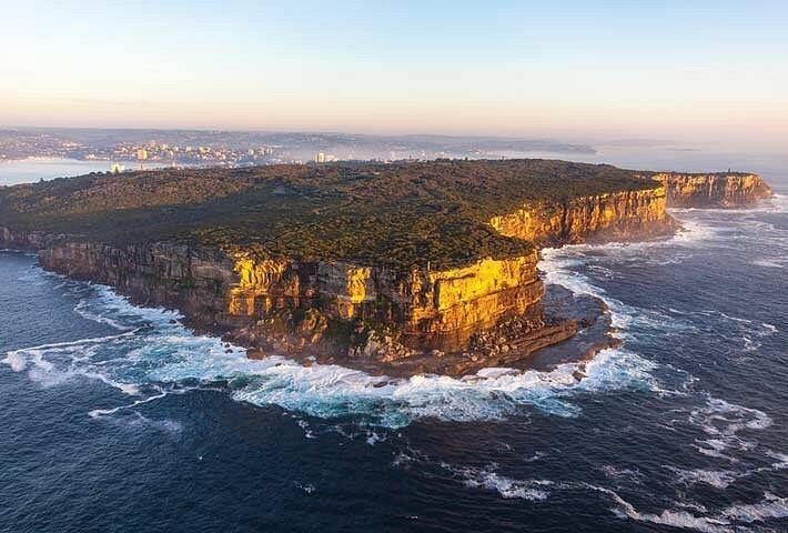
Submerged Architecture of the Heads
The seabed around Sydney Heads is not a uniform ramp from deep water to the harbour. A deeper central passage is bordered by shallower rocky shelves, reef areas and irregular seabed contours associated with the sandstone headlands. Those changes in depth are crucial because wave behaviour is controlled not only by the height of incoming swell, but also by the relationship between wavelength and water depth. As long-period energy moves into shallower water, the wave slows, its wavelength shortens and its height can increase. The crest then becomes steeper, sometimes breaking abruptly where a vessel may have expected a manageable open-water roll.
This is the basic shoaling process, but the Heads add a more complicated three-dimensional setting. A deeper central trench can allow some wave energy to continue with less immediate breaking, while adjacent shelves force other parts of the same wave train to slow and turn. The result is uneven wave spacing and locally focused energy. Research into coastal morphology and seabed control, including the role of inherited geological structure in shaping modern coastal processes, helps explain why waves cannot be assessed from offshore height alone. Authoritative research on wave transformation and coastal hydrodynamics reinforces the importance of depth, seabed form and wave geometry when interpreting conditions close to shore.
North Head’s reef shelves and the approaches near South Head should therefore be treated as different pieces of water. A wave that remains rounded over deeper ground may steepen as it crosses a shelf, while a neighbouring section continues through deeper water before converging again near the entrance. This is one reason the breaking face between the headlands may be substantially more severe than the significant wave height reported offshore. Significant wave height is an average drawn from the highest third of measured waves, not a promise that every wave will match that number. A maximum wave can be considerably larger, and local shoaling can make an individual peak stand up sharply.
| Feature | Effect on incoming swell | Practical implication |
|---|---|---|
| Deeper central passage | Allows more wave energy to travel without immediate breaking | May offer a less abrupt approach, but does not remove steep peaks or crossing seas |
| North Head reef shelves | Slows and focuses portions of the wave train | Expect uneven crests, sudden breaking and changes across a short distance |
| South Head channel and adjacent rock | Creates depth contrasts and wave refraction | Do not assume the line closest to the cliff is the smoothest route |
| Harbour entrance boundary | Brings ocean swell into a confined tidal corridor | Allow for reflected energy, ferry traffic and limited room to alter course |
When Ebb Tides Collide with Tasman Energy
On a falling tide, a large volume of harbour water is moving seaward through the entrance. That outward flow can oppose an incoming swell, particularly when the swell is directed into the Heads. The current does not need to be extreme to change the shape of a wave. When wave motion travels against current, the wave’s apparent speed relative to the water is reduced, wavelength shortens and the crest can become steeper. Wind blowing against the same flow adds another layer of short, irregular sea on top of the longer swell.
This combination is most uncomfortable and potentially hazardous where the flow is concentrated around reefs, headlands and turning water. Near Middle Head and the Sow and Pigs Reef, reflected and refracted waves can meet the main incoming train from different angles. The result is the familiar washing-machine effect, with short-lived holes, sharp peaks and irregular quartering seas rather than one predictable line of swell. Conditions can change within minutes as the vessel moves between the deeper corridor and shallower edges.
Tide tables provide predicted water levels, but they do not automatically identify the exact moment or location of slack current. Local current timing can differ from the published high or low water time, and wind-driven circulation can complicate the pattern. A crossing planned near slack water may reduce the steepening effect of an opposing ebb, but slack is not a guarantee of calm conditions if the offshore swell is large or the wind is fresh. Before committing to a route, consult the official guidance on Waves and swell for vessel assessment, then apply it to the actual vessel and crew.
- Check whether the tide is rising, falling or near a local slack period, rather than relying only on the published high or low water time.
- Look for wind against tide, especially when wind direction drives short seas directly into an incoming ocean swell.
- Expect the steepest and most confused water near reef edges, headland corners and areas where reflected waves meet the main train.
- Remember that a comfortable inner-harbour departure can become a poor ocean crossing if conditions have changed during the run to the Heads.
- Set a vessel-specific limit before departure and turn back while there is still room and sea room to do so comfortably.
Refraction and Cliffside Rebound Chop
The vertical sandstone cliffs around Sydney Heads do more than provide a visual boundary. They form hard edges from which wave energy can reflect. When an incoming swell strikes a steep rock face at a suitable angle, part of the energy is redirected seaward. That reflected motion can overlap the next incoming crest, producing a standing-wave pattern known as clapotis. In the real entrance, the result is rarely a perfectly stationary wall of water. Tides, irregular bathymetry and changing wave direction make the pattern move and break apart, but the underlying interference can still create unexpectedly sharp cross-seas.
Hugging South Head may appear attractive when a skipper is trying to avoid the central line of larger swell, yet the cliffside can be the least forgiving place in moderate conditions. A southerly swell may refract around the outer coast and deflect toward Middle Head, creating a wedge where wave fronts converge. The safest-looking patch can therefore be a temporary gap between peaks rather than a stable corridor. Watch the angle of successive crests, not just their height. If wave lines are arriving from two directions, a course close to the rock may expose the vessel to rebound chop with little room to manoeuvre.
A Skipper’s Checklist for Crossing the Gap
Good preparation begins before leaving the inner harbour. Use the latest Bureau of Meteorology marine forecast, offshore buoy observations and available local wave information, then compare those conditions with the tide prediction and the vessel’s limitations. The Sydney buoy observations can provide useful context about significant wave height, period and direction offshore, but offshore direction may differ from the direction experienced at the Heads because of refraction and shoreline geometry. A seven-second windswell, for example, behaves differently from a longer-period groundswell even if the reported height is similar.
Route planning should also include the return journey. A short transfer, water taxi run or harbour passage can become more demanding if the tide turns, the wind freshens or a swell arrives earlier than expected. Commercial masters should allow extra time for a deliberate approach, passenger briefing and lookout management rather than treating the crossing as a routine extension of an inner-harbour trip.
- Build a complete condition picture. Check the marine forecast, warnings, offshore wave observations, wind trend, swell period, direction and tide stage. Do not use one headline wave number as the go or no-go decision.
- Inspect the vessel’s response limits. Secure loose equipment, confirm bilge and communications readiness, brief passengers and consider how the hull behaves when climbing, descending or crossing a steep wave at an angle.
- Use disciplined throttle control. Maintain enough speed for positive steerage, but avoid charging at crests. Reduce speed before the bow reaches a steep face, keep the hull settled on the descent and avoid launching the vessel off the top.
- Choose the corridor for the actual swell direction. A southerly swell may refract toward the Middle Head side, while a north-easterly pattern can produce a different exposure across the entrance. Reassess visually rather than following a fixed track out of habit.
- Keep a dedicated lookout. Scan beyond the immediate bow for ferries, commercial traffic, crossing craft and larger peaks hidden behind nearer waves. At the same time, monitor the stern because a following sea can overtake the vessel during a course alteration.
- Leave an exit option. If the wave faces are growing, the boat is slamming, passengers are losing stability or the intended corridor is closing with traffic, slow down and return to sheltered water early. A decision made inside the harbour is usually easier than one made in the confused water at the entrance.
Mastering Sydney’s Gateway with Confidence and Respect
A safe crossing between Sydney Heads comes from connecting several modest-looking influences rather than searching for one perfect forecast number. Bathymetry changes the depth beneath each part of the wave. Shoaling turns smooth swell into steeper faces. An ebb tide can compress the wavelength and build pressure waves, while wind against current adds roughness. Cliffs, reefs and headlands then refract and reflect the energy, creating localised cross-seas that may bear little resemblance to the open-water report.
Patience is a practical seamanship tool at this entrance. Pause inside the harbour to observe the pattern, compare successive wave sets and watch how commercial vessels are handling the crossing. Keep the helm proactive, maintain room to alter course and never allow a timetable, passenger expectation or familiar route to override the conditions in front of the bow. Sydney Heads reward respect for boundaries. With careful timing, realistic vessel limits and constant observation of the water itself, the passage can be managed with confidence rather than guesswork.