Sandstone and Solitude: The Changing Roles of Shark Island
Oct 05
A Solitary Sandstone Haven in Sydney Harbour
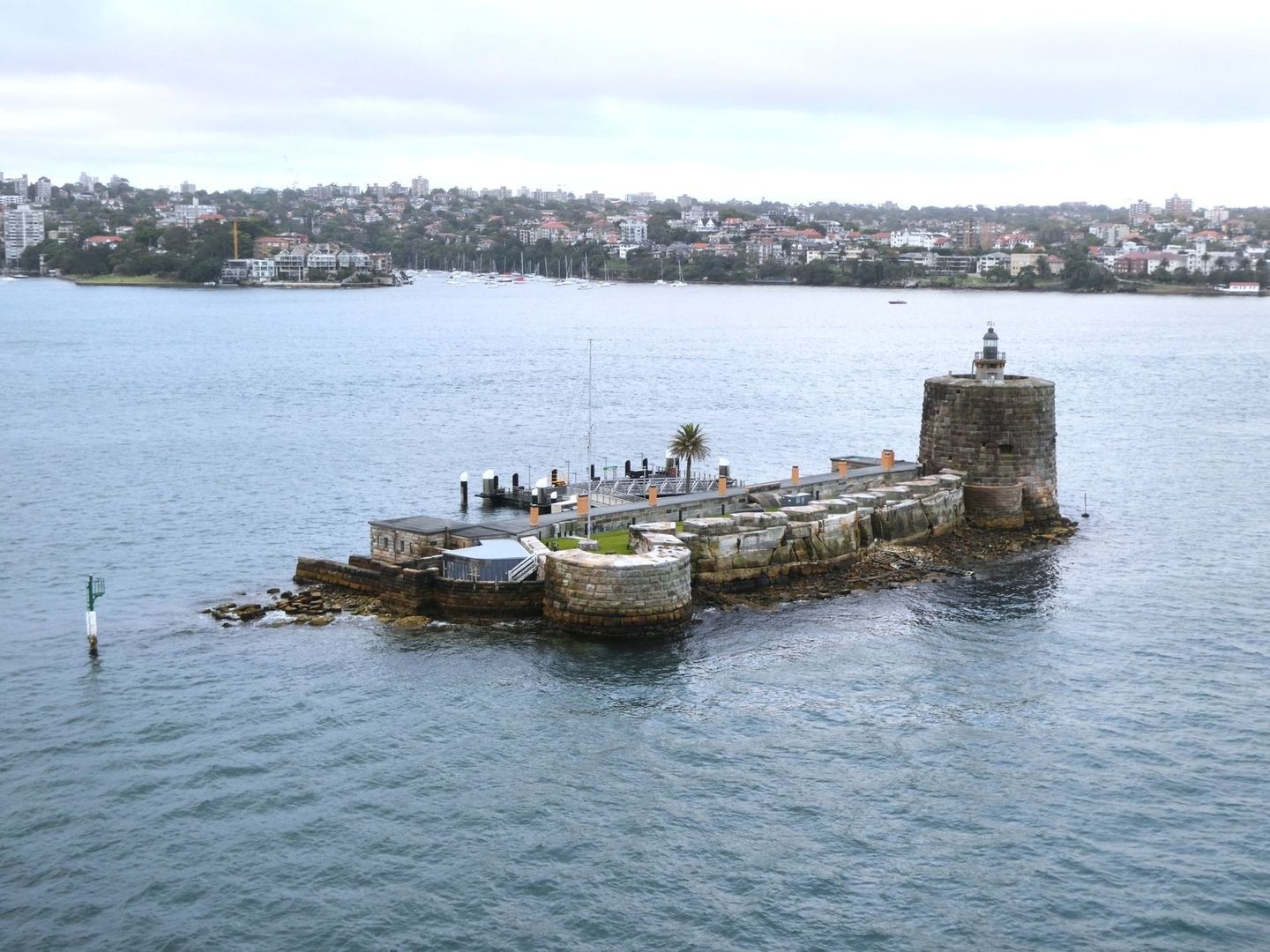
From the water, Shark Island, or Boowambillee, appears almost improbably close to Sydney and yet distinctly apart from it. This 1.5-hectare sandstone outcrop lies about one kilometre from the mouth of Rose Bay, surrounded by the working harbour and framed by the city”s modern skyline. Boats cross the wider waterway, aircraft pass overhead and the Harbour Bridge, Opera House, Manly and the Heads form a familiar panorama, but the island itself retains a quieter rhythm.
That sense of separation is not simply scenic. Shark Island”s story reaches from the drowning of an ancient river valley and the continuing cultural relationships of First Nations people to its later use as an animal quarantine site, naval depot and carefully landscaped picnic reserve. Today, access is planned rather than spontaneous, and the island is protected within Sydney Harbour National Park. The result is a place where modest infrastructure, sandstone craftsmanship and low-impact recreation allow a remarkably old harbour landscape to remain legible.
Deep Geological Time and the First Custodians of Boambilly
Sydney Harbour began taking its present form when rising sea levels flooded an ancient river valley between approximately 10,000 and 6,000 years ago. Higher ridges became headlands, while resistant sandstone crests survived as islands and rocky knolls. Shark Island is one of those remnants, a small elevated fragment shaped by the same geological processes that produced the harbour”s coves, cliffs and underwater channels.
Its Aboriginal names, including Boambilly and Boowambillee, point to a cultural history that predates colonial naming. The wider harbour was not an empty waterway waiting to be mapped. Eora and neighbouring First Nations communities maintained detailed relationships with islands, shores, tidal waters, plants and animals. These relationships included fishing, shellfish gathering, travel, meetings, seasonal movement and responsibilities to Country, although the surviving record is incomplete and has been heavily filtered through colonial observers.
Along harbour shores, shell beds and middens can preserve evidence of long-term food gathering, while sandstone overhangs offered shelter, working surfaces and places where material traces could accumulate. The exact use of every feature on Boambilly should not be assumed, particularly where archaeological investigation is limited, but the island belongs to a wider maritime cultural landscape. For further context on colonial descriptions, changing names and the harbour”s maritime past, consult this Authoritative Source.
- Rising seas transformed an ancient valley into the drowned river harbour recognised today.
- Sandstone outcrops created natural high points, shore platforms and sheltered edges.
- Harbour life depended on close knowledge of tides, marine resources, weather and safe crossings.
- Aboriginal connections to the island and surrounding waters continue beyond the colonial historical record.
Quarantine Outpost to Naval Depot
Many Sydney Harbour islands were gradually altered until they became peninsulas or were absorbed into larger harbour facilities. Roads, bridges, reclamation and land infilling reduced the physical separation that had once defined places such as Darling Island, Glebe Island and other former islands. Shark Island followed a different path. Its small size, surrounding shallows and offshore position made permanent connection less useful than retaining its isolation, particularly when isolation itself was the reason for selecting the site.
During the colonial period, the island served public-health and animal-management purposes. It was used to quarantine cattle and dogs, keeping potentially infectious animals away from Sydney”s expanding herds, streets and commercial activity. An offshore quarantine location offered a practical barrier: animals could be held apart from the mainland while authorities assessed disease risks and managed movement by water. This was functional rather than picturesque, and it placed the island within the broader network of harbour sites used for administration, defence, storage and containment.
Shark Island later became a naval storage depot and maritime service station, adding another layer to its working harbour identity. Navigation lights were installed after shipwrecks and drownings highlighted the hazards of the surrounding waters. Its position near Rose Bay also gave it visibility along important harbour routes, while the rocky shoreline remained a reminder that a short crossing can still involve exposed water, changing wind and tidal movement. In this respect, Shark Island”s islandness was never merely an inconvenience. It was an operational asset.
Carved Grottos and Public Recreation in the Twentieth Century
By the early twentieth century, pressure grew to restore Shark Island as a public reserve rather than retain it solely as a working or restricted harbour enclave. Restoration was secured in 1900, and the island reopened to the public in 1905. Management later passed to the Sydney Harbour Trust in 1917, before Shark Island became part of Sydney Harbour National Park in 1975.
The recreational landscape that emerged was distinctly Edwardian. Workers shaped sandstone into hand-hewn grottos, retaining walls and sheltered edges, while trees and planted shade canopies softened the working traces of the earlier site. Grassy areas, picnic shelters and broad harbour outlooks encouraged visitors to linger. These features were not an attempt to erase the island”s geology. Instead, they worked with the existing sandstone, turning practical excavation and retaining work into a setting for public leisure.
| Period | Role and character |
|---|---|
| Before European arrival | Part of a wider First Nations maritime and cultural landscape. |
| Nineteenth century | Animal quarantine location, with navigation concerns shaped by nearby maritime hazards. |
| Later colonial period | Naval storage depot and maritime service station. |
| 1900 to 1905 | Restoration as a public reserve followed by reopening. |
| Twentieth century | Edwardian-style picnic reserve with grottos, shade and landscaped foreshore areas. |
| Since 1975 | Protected as part of Sydney Harbour National Park. |
The island also holds a place in Australian sailing history. The first Sydney to Hobart yacht race began from Shark Island on Boxing Day in 1945, with nine yachts taking part. Today, the island remains a valued viewing point for harbour events and race starts, although its appeal is often strongest when there is no major spectacle at all. A quiet picnic beneath the trees, with ferries and yachts moving beyond the sandstone foreshore, reveals how successfully the former outpost became a public retreat.
Practical Advice for Navigating and Landing on the Island
Shark Island is not a standard ferry-stop destination where visitors can simply arrive and expect a regular public transport connection. Access is primarily arranged through a booked tour, commercial operator, water taxi, private vessel or another approved landing arrangement. The official Shark Island visitor information states that advance bookings are essential. The island is generally open from sunrise to sunset, subject to closures and operational conditions, and every visitor aged five and over must pay a $7 landing fee. This fee is separate from park-entry charges and is not covered by an annual NSW Parks Pass.
Private vessels may drop off and collect passengers but cannot moor at the island. That detail matters when planning a picnic or group outing: confirm the landing arrangement, meeting wharf, identification requirements, collection point and weather fallback with the operator before departure. A water taxi or charter can provide a direct scenic transfer, but the skipper still needs clear information about passenger numbers, luggage, mobility needs and the intended landing window. Shark Island has no wheelchair access, and facilities are limited, with no barbecue facilities or on-island shop.
Conditions around a small sandstone island can change quickly. Check the maritime forecast before leaving, allow time for wind and tide adjustments, and avoid treating a calm Rose Bay departure as a guarantee of equally gentle conditions offshore. Shallow water, rocky edges, boat traffic and wash from passing vessels all require attention during approach and transfer. Landing should follow the operator”s instructions, with passengers moving only when the vessel is securely positioned and the skipper confirms it is safe.
- Book the landing or tour in advance and confirm the current fee, access conditions and meeting location.
- Check official alerts on the day, including closures, event restrictions, poor-weather warnings and fire-danger conditions.
- Ask the operator about wind, swell, tidal timing, boarding arrangements and the expected collection procedure.
- Pack drinking water, food, sun protection, a hat, suitable footwear and any medication required for the full visit.
- Take all rubbish back with you, stay on appropriate surfaces and avoid disturbing wildlife, vegetation, sandstone features or marine life.
Shark Island operates as a low-impact, leave-no-trace national park destination, so preparation is part of the experience rather than an optional extra. Bring reusable containers and pack conservatively, because there is no reliable opportunity to purchase forgotten supplies after landing. Toilets and picnic infrastructure may be available, but visitors should not assume that every facility will suit every need. Before finalising a charter or picnic, review the current National Parks alerts, then confirm details with the operator.
Embrace the Quiet Rhythms of Boowambillee
Shark Island rewards visitors who allow the harbour to set the pace. Sit within a historic sandstone grotto and the layers become easy to sense: ancient rock beneath the grass, tidal water moving around an old island crest, colonial infrastructure at the shoreline and modern Sydney passing beyond it. The island”s appeal lies in this contrast. It is close enough to feel the city”s energy, yet separated enough to make ordinary harbour noise seem distant.
Plan for soft morning light or a calm afternoon tide, leave generous time for the transfer and keep the visit deliberately light on equipment and impact. Respect the foreshore, avoid fragile areas, carry every item back to the mainland and follow current landing instructions. With that care, Boowambillee can remain what its history now makes possible: not an isolated place cut off from Sydney, but a protected harbour sanctuary where sandstone, memory and quiet recreation continue to share the same small piece of water.